
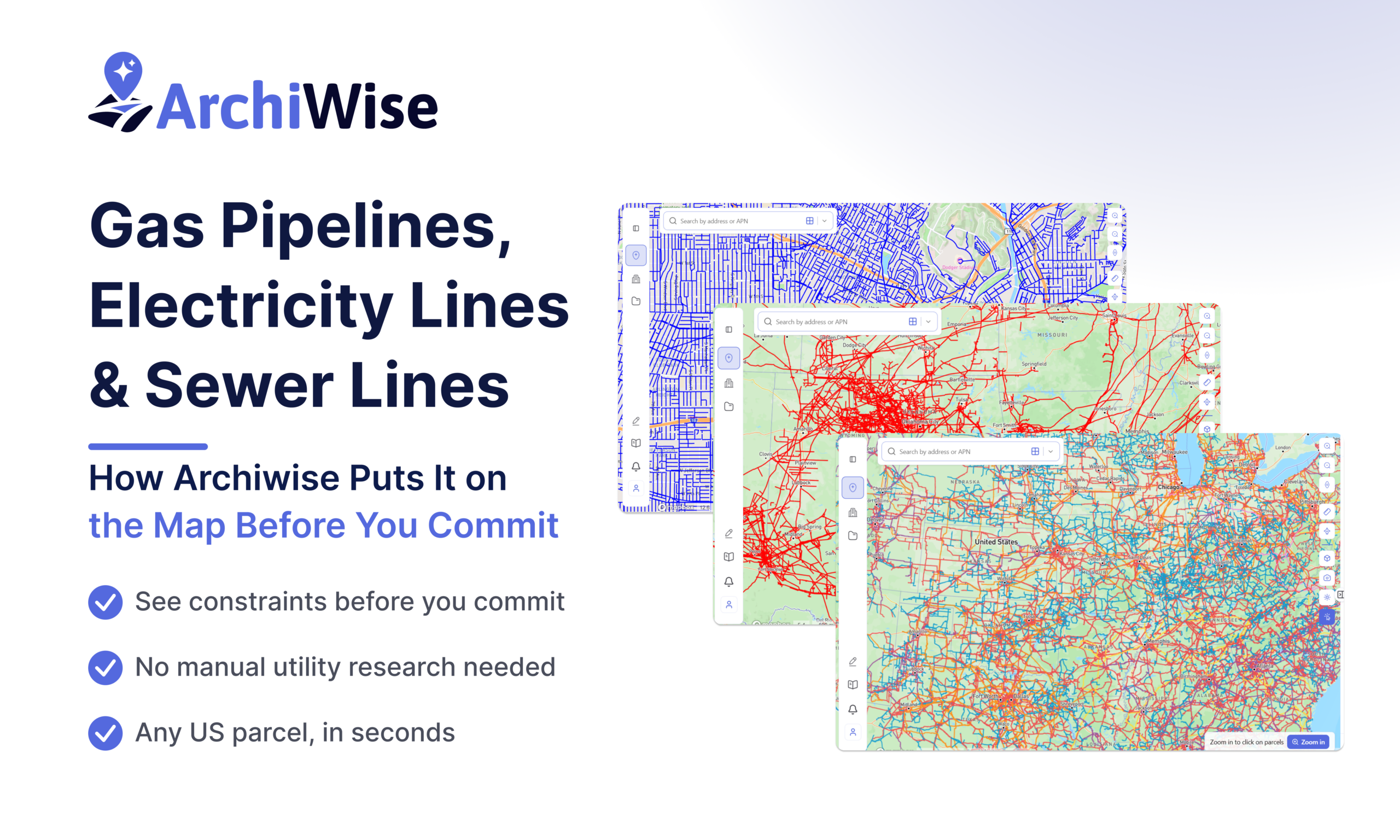

A site can be perfectly zoned, correctly sized, and well-priced – and still fail because of what runs underneath or alongside it. Gas pipelines, electricity transmission lines, and sewer infrastructure don’t show up in a zoning lookup. They don’t appear on a county assessor record. And they don’t get discovered until a developer calls a utility company – usually weeks into due diligence, after significant time and money have already been spent.
Archiwise puts this infrastructure data directly on the map, visible the moment you open a parcel – before any calls, before any commitments, and before any surprises.
Why Infrastructure Data Matters in Pre-Development
Infrastructure constraints are among the most expensive surprises in real estate development. Not because they always kill a deal – but because they are almost always discovered too late.
Gas pipelines can constrain what gets built and where. A pipeline running through or near a parcel requires consultation with the pipeline operator and may limit buildable area, restrict certain uses, or require engineering workarounds. A developer who finds this out after signing a purchase agreement is in a very different position than one who found it before making an offer.
Electricity transmission lines reduce effective developable area. High-voltage lines come with right-of-way requirements and setbacks that vary by voltage level. A line that crosses or runs along a parcel boundary can quietly shrink what’s actually buildable – something that never appears in a standard zoning or parcel analysis.
Sewer proximity determines whether a project is feasible at all. Multifamily, commercial, and mixed-use development requires sewer access at sufficient capacity. A site that sits far from existing infrastructure may require extension costs that fundamentally change the project economics – a fact that typically surfaces at the engineering phase, not during underwriting.
In each case, the data exists. It just wasn’t available in one place, at the earliest stage of site evaluation. Getting it required separate calls to three different utility companies, each with their own timelines and formats. That process takes days, sometimes weeks.
How Archiwise Makes Infrastructure Visible – Instantly
This is where Archiwise changes the picture entirely. Instead of chasing utility companies one by one, a developer can toggle on any infrastructure layer and see gas pipelines, electricity lines, and sewer networks mapped directly onto the same interface used for zoning, parcel ownership, housing incentives, hazards, contextual data, and demographics – for any parcel in the US, in seconds.
And it isn’t just lines on a map. Each layer includes the specific data developers actually need to evaluate a constraint – consultation zones, voltage classifications, right-of-way widths, and buffer distances – pulled directly from federal and utility data sources and rendered with a detailed legend. This is data that previously required a professional inquiry to obtain. Here it’s available before a developer has spent a dollar on the site.
Gas Pipeline – Natural Gas Pipeline Infrastructure
Toggle on the Gas Pipeline layer and the full national gas pipeline network appears as red lines. The legend shows not just the pipeline location but also a 660-foot consultation zone on either side of each line – based on PHMSA/PIPA guidance – shown as a shaded buffer directly on the map.
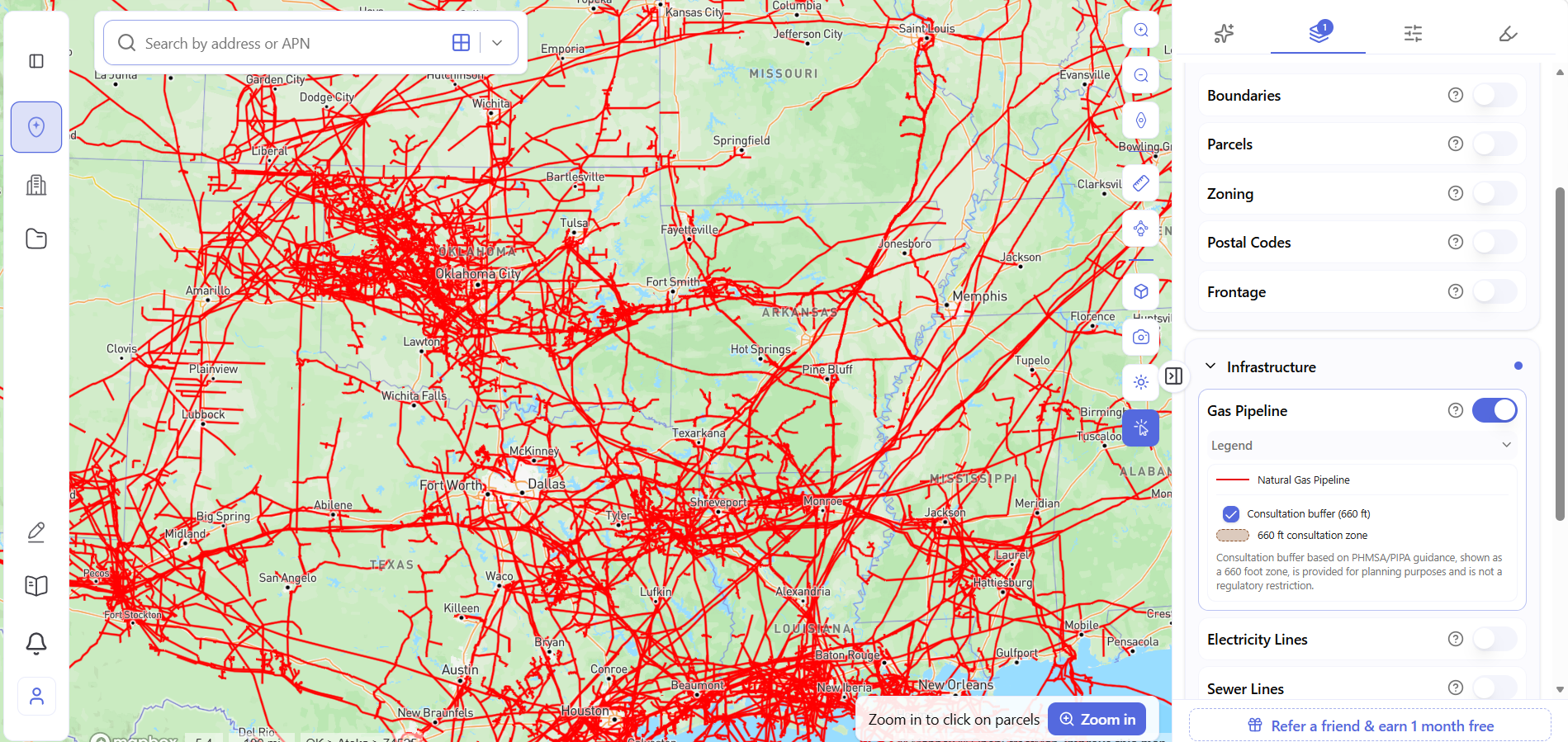
The 660-foot consultation zone is shown for planning purposes – it is not itself a regulatory restriction, but it signals the area within which a developer should expect to engage the pipeline operator before proceeding. Seeing this zone on a site before making an offer is the difference between building that consultation into the timeline and being surprised by it mid-deal.
Electricity Lines – Electrical Power Lines and Transmission Infrastructure
Toggle on the Electricity Lines layer and the full national power grid appears color-coded by voltage level – from blue for lines under 100 kV, through red, purple, orange, and yellow, up to pink for lines at or above 735 kV. Each voltage tier carries a different right-of-way width and consultation buffer, shown in a table directly in the legend.
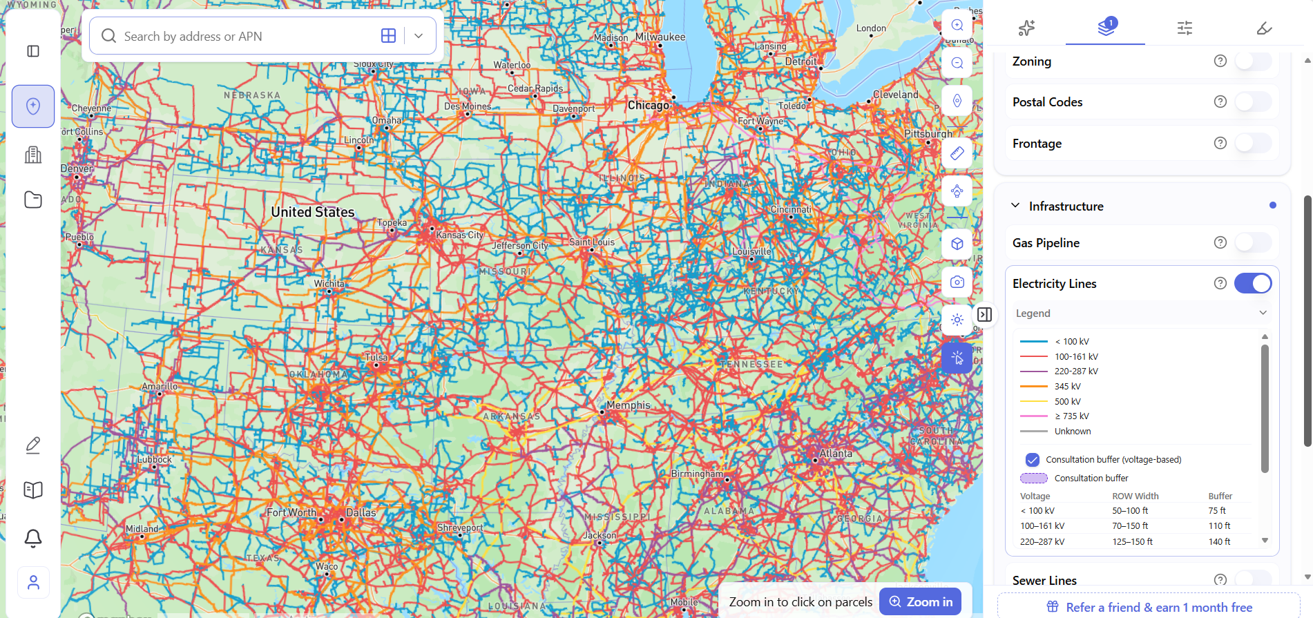
A blue line (< 100 kV) near a site carries a 75-foot buffer and a 50–100 foot right-of-way. A red or purple line (100–287 kV) carries a 110–140 foot buffer. Higher-voltage corridors carry wider restrictions still. Knowing the voltage means knowing the actual constraint – not just that a line exists somewhere nearby.
Electricity Lines coverage is nationwide.
Sewer Lines – Sewer and Wastewater Infrastructure
Toggle on the Sewer Lines layer and the sewer and wastewater network appears as a dense blue grid across the covered area.
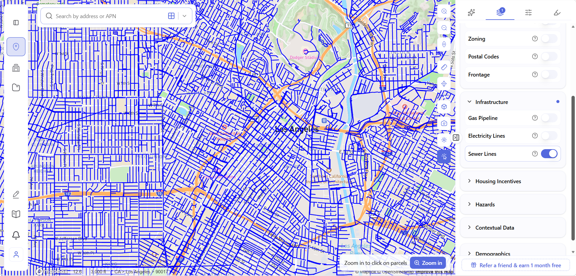
Sewer Lines coverage is currently available for Los Angeles only. Gas Pipeline and Electricity Lines are available nationwide. Sewer coverage will expand as additional data becomes available.
For developers working in Los Angeles, the sewer layer answers a question that otherwise requires a call to the Bureau of Sanitation: where are the existing lines, and how close is this site to them? That answer directly affects connection cost estimates and feasibility analysis for higher-density uses.
Infrastructure in the Context of the Full Site Picture
The value of infrastructure data isn’t just knowing where the lines are. It’s knowing when – and at what stage of the process.
Archiwise’s infrastructure layers sit alongside zoning, parcel ownership, hazard data, housing incentives, and demographic context. A developer evaluating a site sees the full picture in a single view: what can be built here, who owns the surrounding parcels, what risks exist, and what infrastructure constraints apply – before any professional fees, before any utility calls, and before any commitments.
The infrastructure data was always available. It just wasn’t available here, at this stage, alongside everything else a developer needs to make a sound decision.
See Property Data, Infrastructure, Housing Incentives, Hazards, Contextual Data, and Demographics for any US parcel – in one platform, before you commit.
Learn more
ArchiWise helps developers, investors, architects, and brokers go from address to decision in minutes, not weeks.
Whether you’re screening sites for multifamily development, evaluating zoning constraints, surfacing incentive eligibility like QCT and LIHTC, or assessing hazard risk before committing capital, ArchiWise runs every layer of analysis in one place.
Explore how ArchiWise helps teams screen development sites, analyze zoning, and make confident go/no-go decisions faster.